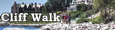
Newport's Cliff Walk History
 Local historians suggest that the first established paths along the Cliff Walk
shoreline were outlined by the local deer ... then the Narragansett Indians ...
followed by the colonials who harvested whatever they could including random
salvage floating ashore from ship wrecks.
Local historians suggest that the first established paths along the Cliff Walk
shoreline were outlined by the local deer ... then the Narragansett Indians ...
followed by the colonials who harvested whatever they could including random
salvage floating ashore from ship wrecks. During the last half of the 1800s, the summer getaway for the wealthy New Yorkers spread from the center of Newport's harbor area to this undeveloped coastal shoreline.
The city was a fantastic center of Victorian extravagance in architecture and social competition of millionaires benefiting from the industrial revolution. Many of the great mansions built during those times were ideally located on this scenic overlook of the Rhode Island Sound and Atlantic Ocean. Serious development of Cliff Walk started about 1880, and the estate owners spent the next 50 years (to about 1929) improving the walk piece by piece. The Great Depression threw the walk development into the deep freeze.
Over the last 150 years the public and some of the wealthy estate owners have often clashed over access rights both along the shore and to the shore. Even today there are disputes at several points both along the walk and at public access points.


Owners at times have moved paths to more dangerous routes; erected walls, fences and boulders directly across the walk; planted bushes and trees to block or discourage access to the walk; and posted dogs and even bulls to scare people away.
 Cliff Walk was
protected by the combination of long term public use, the "Fisherman's Rights"
granted by the Colonial Charter of King Charles II, and a passage in the Rhode
Island Constitution that granted the public "rights of fishery and the
privileges of the shore to which they have heretofore been entitled." Now
centuries of prior use have guaranteed the legal right of people to walk along
the cliffs.
Cliff Walk was
protected by the combination of long term public use, the "Fisherman's Rights"
granted by the Colonial Charter of King Charles II, and a passage in the Rhode
Island Constitution that granted the public "rights of fishery and the
privileges of the shore to which they have heretofore been entitled." Now
centuries of prior use have guaranteed the legal right of people to walk along
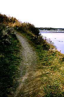
the cliffs.The walk's construction was originally just a path along the shoreline. In some areas the public moved a few stones aside, some owners neatened their portions of the walk, others built tunnels or bridges in a public spirited move to make the walk enjoyable to the public ... with the added benefit to them of being able to overlook the walkers on the lower path.
In effect the walk is a public right of way over private property owned by the waterfront property owners. The walk historically was really a path or trail with many rustic components, and in some spot has never changed.
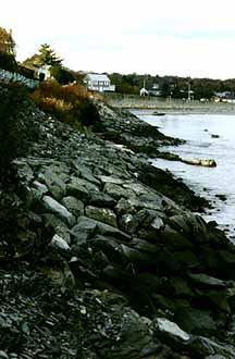
The 1938 and 1954 hurricanes
 destroyed a number of areas and the Walk could have deteriorated
completely. In the 1970-1976 time frame the U.S. Army Corps of Engineers spent
about two years supervising basic repairs using gravel, asphalt, and rocks
weighing tons fitted to form revetments. Both the City and State also
contributed funds for repairs covering about 9200 feet between Newport Beach to
the west property line of Marble House at Sheep Point. (the second tunnel going
south).
destroyed a number of areas and the Walk could have deteriorated
completely. In the 1970-1976 time frame the U.S. Army Corps of Engineers spent
about two years supervising basic repairs using gravel, asphalt, and rocks
weighing tons fitted to form revetments. Both the City and State also
contributed funds for repairs covering about 9200 feet between Newport Beach to
the west property line of Marble House at Sheep Point. (the second tunnel going
south). The Chairman of the Cliff Walk Committee during those years was Claus von Bulow and he was assisted by one of Newport's colorful mayors Humphrey "Harp" Donnelly III.
Further improvements were made in the early 1980s and funded by the National Park Service Land and Water Conservation Fund. In 1993 and 1994 an additional $3.4 million was spent on new retaining walls to check erosion along the northern cliffs and to repair damage from Hurricane Bob that occurred in 1991. In 2004 additional improvements included the area south of Ruggles Ave. and extended to Reject's Beach at Bellevue Ave.
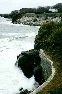
Hurricane Sandy in Oct. 2012 washed out several sections of the walk and closed about half of the walk for just over 13 months. Some of that delay was in response to objections from surfers who considered some of the temporary staging areas for large "armour" stones would cut down on their sport. Eventually nearly 700 tons of stone was used instead of the orginally suggested 80,000 tons, according to a report by the Providence Journal.
The over $5 million project was financed through federal aid with the State matching 20% of the federal aid. Areas involved were a walk near Rough Point, a cement walk at the edge of Miramar, a cement walk near the Waves, and many smaller segments.
CliffWalk.com is always "under construction," and pieces will be continually added.
If you have information to add, corrections or suggestions, please contact webmaster at VJ@WebGhosts.com
Web services provided by: WebGhosts.com
Content and images © copyright 2022 Webghosts.com
3.1.22